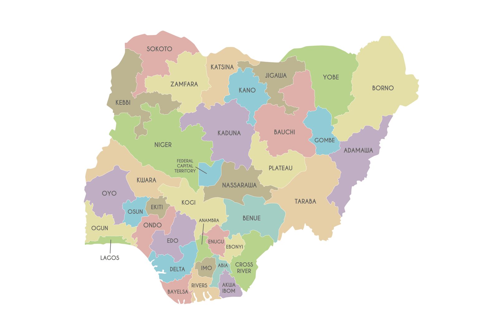
Nigeria is a federation of 36 states and the Federal Capital Territory (FCT), divided into 774 local government areas. The states are commonly grouped into six geopolitical zones. Use the tables below as a quick reference to every state and its capital.
North Central (plus the FCT)
| State | Capital |
|---|
| Benue | Makurdi |
| Kogi | Lokoja |
| Kwara | Ilorin |
| Nasarawa | Lafia |
| Niger | Minna |
| Plateau | Jos |
| Federal Capital Territory | Abuja |
North East
| State | Capital |
|---|
| Adamawa | Yola |
| Bauchi | Bauchi |
| Borno | Maiduguri |
| Gombe | Gombe |
| Taraba | Jalingo |
| Yobe | Damaturu |
North West
| State | Capital |
|---|
| Jigawa | Dutse |
| Kaduna | Kaduna |
| Kano | Kano |
| Katsina | Katsina |
| Kebbi | Birnin Kebbi |
| Sokoto | Sokoto |
| Zamfara | Gusau |
South East
| State | Capital |
|---|
| Abia | Umuahia |
| Anambra | Awka |
| Ebonyi | Abakaliki |
| Enugu | Enugu |
| Imo | Owerri |
South South
| State | Capital |
|---|
| Akwa Ibom | Uyo |
| Bayelsa | Yenagoa |
| Cross River | Calabar |
| Delta | Asaba |
| Edo | Benin City |
| Rivers | Port Harcourt |
South West
| State | Capital |
|---|
| Ekiti | Ado-Ekiti |
| Lagos | Ikeja |
| Ogun | Abeokuta |
| Ondo | Akure |
| Osun | Osogbo |
| Oyo | Ibadan |
How Nigeria's map got here
- 1963: four regions (Northern, Eastern, Western, Mid-Western).
- 1967: 12 states created by the Gowon government.
- 1976: 19 states; the decision to move the capital to Abuja.
- 1987 and 1991: 21, then 30 states. Abuja became the capital in December 1991.
- 1996: 36 states, the current map.
Quick facts
- Largest by area: Niger State. Smallest: Lagos State.
- Most populous: Lagos and Kano.
- Coastal states: Lagos, Ogun, Ondo, Delta, Bayelsa, Rivers, Akwa Ibom and Cross River.
- Borders: Benin (west), Niger (north), Chad (north-east) and Cameroon (east).
Planning a move or a trip home? See our guides to postal codes by state and getting from Lagos to Abuja.
Sources